
Gates, ceremony hall and historic tombs
The interactive map helps you orient yourself between the entrances and the ceremony hall. It does not identify individual private grave numbers. Ask the cemetery administration for the section and grave number before searching for a specific grave.
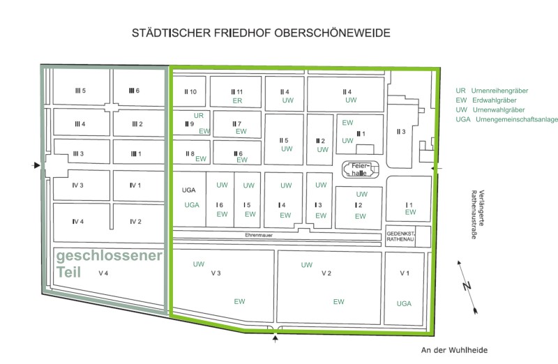
Official site plan
The site plan shows burial sections, the ceremony hall and the Rathenau memorial. Its abbreviations identify grave types: UR means individual urn row graves, EW selectable coffin graves, UW selectable urn graves and UGA a communal urn area. The plan is a JPG image.
Using a wheelchair or walking aid
Start with the main paths for orientation. Paths inside some sections are only 50 cm wide. An accessible toilet is available; its precise location is not yet marked on this map.
Open the official cemetery plan (JPG)
Related information: Address and directions · Grave search.